Historically US 6 went through Leadville, Colorado
^ date reposted to this blog
Feb. 15, 2017: originally posted to my old blog
Jan. 2020: last updated
Vail Pass was opened to US 6 traffic about three years later, even though initially it was only graded (not surfaced). Travelers were undoubtedly anxious for this improvement, since it reduced the distance along US 6 by about 30 miles:

This photo was looking northbound on SH 91, but this road also carried US 6 traffic for about three years. This is north of Leadville, approaching the hairpin right before the final segment leading to the summit of Fremont Pass. I took this photo because this straightaway happens to be directly aligned with the summit of McNamee Peak (13,780'), a major triple watershed:
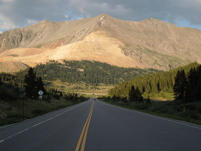
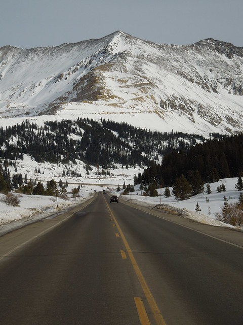
A ridge comes down from the peak, straight towards the camera at first, and then right about where it has been disturbed by activity at the Climax Mine, it veers off the left edge of the photo. That is Ceresco Ridge, which forms the summit of Fremont Pass, and also divides the Colorado River basin (to the left) from the Arkansas River basin (to the right). Water flowing down the far side of the peak goes into the Platte River basin. The summit visible to the left (north) of McNamee is Clinton Peak (13,857'), and the high point to the right is Traver Peak (13,852'). (The reason they look a little lower than McNamee is they are a little more distant from this vantage point.) This next photo is a winter scene from the same perspective:


Feb. 15, 2017: originally posted to my old blog
Jan. 2020: last updated
In 1937, when the US 6 designation was extended west from Greeley (through the rest of Colorado and all the way to Long Beach, California), Vail Pass had not yet been built. Shrine Pass existed, but there was no town of Vail, nor was there any type of road running directly between Minturn and "Wheeler" (today's Copper Mountain):

Shrine Pass was not considered to be a good candidate for development into a primary state highway, so US 6 traffic was directed further south from Copper Mountain, along today's SH 91. Drivers had to go over Fremont Pass and all the way down to Leadville. There, traffic was directed north (overlapped with westbound US 24) over Tennessee Pass and up to Minturn.

c. 1937, CDoT
Shrine Pass was not considered to be a good candidate for development into a primary state highway, so US 6 traffic was directed further south from Copper Mountain, along today's SH 91. Drivers had to go over Fremont Pass and all the way down to Leadville. There, traffic was directed north (overlapped with westbound US 24) over Tennessee Pass and up to Minturn.

c. 1940, CDoT


Comments
Post a Comment